
Snowkite Conditions Archives
What a great season!!!! Last day March 12 2013
(older reports below)
3/24/2012 Spring conditions are in full force with warm temps during the day and freezing at night. Most of the snow from the last storm is consolidating into the ice layer and will make great corn conditions midday, fast hard conditions in the mornings. Ice thickness is highly variable with the edge ice melting out near exposed shorelines but up to 18" of good ice out in the middles of some lakes. Better ice conditions as you head further north of the North Conway area. If venturing out check with locals for ice conditions on specific lakes.
3/11/2013 The layer of snow is still messing up surface conditions on lake south of the North Conway area. We are hoping the warm temps will know the snow down and get us some decent late season conditions on the lakes that froze early this season. Lakes that froze late, in our estimation, are pretty much out of
play for the season. Be very careful if venturing out on ice south of North Conway.
3/1/2013 We have just received a fair amount of snow locally on top of the snow from the previous storm. This is causing the ice to be weighted down and water is coming up through cracks, ice fishing holes and over the edge ice making for a pretty sloppy mess. If you have wide powder skis you will be able to stay
on top and stay dry but getting on the ice, setting up and packing down is going to be messy. Keep in mind that this does effect ice safety and if
you are venturing onto the lakes the rule of thumb for slush covered and weighted ice is that it is half as strong as it was prior to slush and
weight. This will likely only be an issue with lakes south of us with thinner ice. Check with locals with recent experience with the ice before venturing out if you don't know the area.
2/25/2013 Current riding conditions are in flux. After a busy Holiday weekend as well as some usable snow accumulation we've seen some heavy snowmobile activity on many of the local lakes. Much of which was during warm spells followed by a cold snap. High traffic areas are very rough. On Big lakes like Winnepesaukee the smaller bays are very rough from trucks driving through the slush which is now frozen. We did a 75 mile tour of Winnepesaukee last week and found bad surface in Melvin, Center Harbor, Meredith Bay, Wiers and Ellecoya. There are good areas out in the less heavily traveled areas as well as the broads but we want to remind everyone that we feel the broads are a risky venture. There have been Snowmobiles out there but very few and they were clearly moving at high speeds. There is substantial open water between the Wiers and the broads as well. With this recent heavy snow we are finding many places are developing a slush situation that won't like subside until we get a rain event or heavy day time snow melt to consolidate the strata.
2/13/2013 Post Nemo snow conditions have been quite good the last few days. Some areas have huge wind driven whales while others are flat and others still are like huge bump fields. We received some rain afterwards and there has been a death crust but the warm temps over the next few days will consolidate that. Mild, spring like conditions for the next few days will make for some great riding with fat skis and snowboards. Keep in mind that as you track things up in the warm those tracks will be there to make things rough when the temps drop. Extended warmth or rain will fix it but you may want to wait till mid day to ride so things are not so harsh. =)
This weekend is looking good locally, more wind here in the central part of the state than up north.
Stay tuned.
2/8/2013
We have a huge Nor' Easter heading this way. and lessons are on hold until Sunday. It will be nice to have snow again as much as some of us enjoy riding the glass. Yesterday I flew from Center Harbor to Ellacoya in Gilford NH to check the conditions of "The Broads" aka the widest parts of the lake.
What I found was both amazing and shocking. The surface conditions were HIGHLY VARIABLE as you can see from the images to the left. There were channels of open water and some spots of very thin ice. We wanted to see the conditions before the snow came so we would have an idea how safe the conditions would be after this storm. Unfortunately given what I saw yesterday we don't feel that the broads are going to be safe anytime soon especially after this snow and high wind event beat the heck out of the already fragile ice sheet. We have a feeling we will not be riding across the broads again this winter. But you never know.
On another note the Rotary Ice Fishing Derby is this weekend so there will be heavy congestion in the parking areas and on the ice with all the ice fishing activity on Winne as well as the nearby surrounding lakes. Space will be at a premium and made worse by the weather conditions so we recommend if possible to ride somewhere less crowded this weekend.
2/6/2013
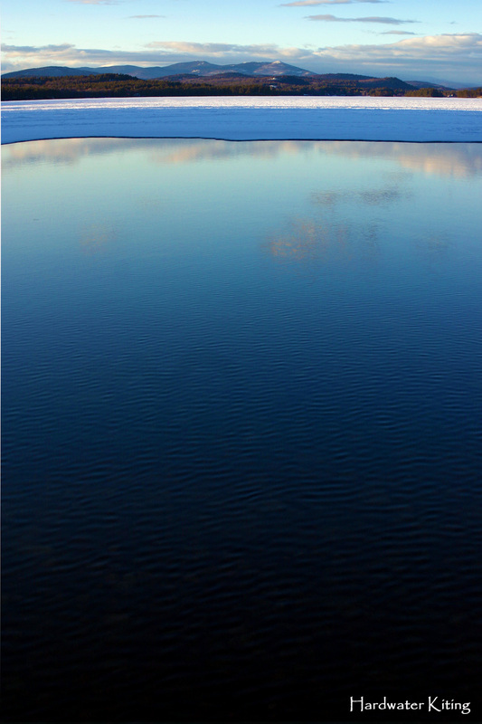
Last weekend, in spite of the poor wind reports was AWESOME! As we guessed the surface conditions did firm up and the ice as you can see in the shot to the left was smooth as glass. Our student for Saturday was a little uneasy about riding on it as he had never considered that you could but at the end of the day he seemed to love the hard smooth ice as much as we do. In fact he rode 17 miles solo on it and loved every moment.
We have a storm due in on Friday and into Saturday. There are various reports some saying a foot or more of accumulations others saying that it is going to miss us here in the north. It looks like it may hit Lake Winnipesaukee which would be awesome as the broads have just recently frozen over enough to ride.
We'll update more on the snow situation as it unfolds.
1/31/2013
WOW! just WOW! Okay so,
it is currently 54F here in North Conway.
What does this mean? Well for starters obviously things are melting rapidly and the awesome wind slab snow surfaces that we've been enjoying from Winnipesaukee all the way to Moosehead are pretty much a memory. We received some snow just prior to this meltdown/rain event and it may help with the surface conditions when the next cold front comes through today. Temps are going to drop drastically in the next 24hrs so be aware of the potential for extremely high winds. The snow melt running into the lakes from the hills will have some affect on edge ice and increased inflow may weaken the thinner ice sheets at the inlets. Surface conditions this weekend will likely be on the firmer side than they have been the past few weeks of lessons. We'll know more after the temps drop back to normal.
Stay tuned.
1/25/2013
After a week of below freezing temperatures we have some really great riding opened up and are looking forward to a great weekend. Winds are forecasted 12-15mph NW which works great on a majority of the area we ride. Surface conditions on all the lakes have been found to be a variable mix of firm wind slab punctuated by stretches of frozen slush ice that had come up through the cracks. Wind chill factors are still a consideration but becoming less so as the weekend approaches. Be sure to keep any exposed skin covered and remember to take breaks once in a while to warm up if needed.
1/22/2013
Current riding condition here in the north country are variable but for the most part very good. We survived last weeks warm spell and many of the lakes that had small holes appear have since refrozen. Surface conditions on all the lakes are variable but by and large pretty good. Not much clean ice but not a ton of snow either.
We haven't received any real snow in the last couple weeks and the warm spell took a toll on land based conditions. We've been riding Lake Chocorua when pressed for time and lately out of Melvin Village on Lake Winnipesaukee. Ice conditions on all lakes are still in a state of flux so please check with locals about the conditions before venturing out.
1/11/2013
Well it's been a while between reports and I apologize for that. In the last week a few of our riding areas have started coming into play but at the same time we've just moved into a warm spell so I would hold off on venturing onto the most recently frozen bodies of water south of the Mount Washington Valley region until the temps drop down again.
We rode Squam Lake yesterday. The lake is covered with about 4-5" of semi black ice. I say semi black as it does have some air bubbles in it and is not absolutely crystal clear. This means that it's still stronger than white ice but not as strong as black ice can be. Yesterday we had temps in the mid 40's (F) and the first .5 inches degraded considerably in the sunshine. Warm temps and rain/mix are in the forecast for this weekend with no wind to speak of.
We also flew out of Center Harbor. Same conditions were found there. I flew out as far as 1 mile island but the ice continued further out.
Thin spots near points and inlets are very visible. However, I'm not confident that the new black ice is solid enough (everywhere on the given lake) to be what I would consider safe and I am staying off those lakes until we get the cold snap back. My understanding of warm temps and how they effect ice is that if the temperature rises above freezing for six hours during a 24 hour period you should double the recommended minimum thicknesses. So if there is 4 inches of black ice in the heat for an extended period like we're facing now, it's best to avoid it.
Lessons for this weekend have been cancelled and will be rescheduled. Thanks to everyone for being so cooperative and understanding.
1/2/2013
Happy New Year! Well, as we feared the slush situation has turned it's ugly head and our lakes that had ice locally are now covered in the stuff. Hopefully the cold temps will set up the slush if not we have other options with a little travel. Currently the temps are in the single digits and will remain cold for the rest of the week with no snow in the forecast. This will help open up more riding areas in the days to come. We will continue to inspect these areas and monitor their conditions. Lessons are on from this weekend on out.
12/29/2012
Managed to get a session on Lake Chocorua. Ice thickness is between nothing and 5" depending on where you look. Inlets, outlets, springs and swampy areas are all likely to have thin ice and the snow pack on top has ground the ice production to a halt. The snow is weighing the ice sheet down, causing it to sink and water is coming up over the edges and through any holes or cracks. The result is a slush layer under the snow that goes out about 30' and random slush near cracks. We have a forecast for the coldest temp in 2 years so hopefully it will set up any snow covered ice as well as snap freeze any open water. It's starting to feel like snowkite season. There is a decent snowpack so land
riding is shaping up and we are getting more snow as I type. We should be good to fully operational by next weekend!
12/27/2012
NOR'EASTER!!!!
Winds are about 15-25mph with gusts to who knows what. Snow is coming in slow but steadily and so far we've gotten about 4" as of 9:35am. This is supposed to continue until tonight and then clear up tomorrow. We're waiting to see how this affects the ice we have and hopefully there's enough on the spots that have frozen to support this extra weight. If not the snow will sink the ice and any cracks, holes (from fishing our ice tests) will allow water to come up from below and spread out on top. In deep snow this makes a slush layer that can't freeze until the deep snow is gone. If we're lucky, the ice is good enough to support the load and we'll just have some snow on the surface. We'll do some site inspections and keep you all posted
12/25/2012
MERRY
CHRISTMAS!!!!!!!!
We did a few more site assessments yesterday and I'm happy to report that these cold temps are paying off huge and locations that are ice dependent are shaping up fast and land based locations are holding snow. We got a little snow today and there is more snow and cold in the forecast. Thursday is looking like it's going to be a wind/snow event with winds blowing around 15-20 knots. Everyone have a great Christmas and a Happy New Year! Conditions are shaping up and lessons will be starting SOON!
Thanks to everyone for their patience and we will be seeing you all very soon.
12/23/2012
Looks like Winter may decide to actually show up for a week or so! Temps aren't supposed to get above freezing for at least 5 day and they will be down in the teens at night. The snow that we received that would have killed ice production on the local lakes was killed off by the 2" of rain and is now consolidated and setting up as a gray ice layer on top of the black ice. This will be good for the immediate future. We recommend staying off any ice south of the Mount Washington area and ask around before venturing out. I know a lot of people are "chomping at the bit" but we want to be safe out there.
We are going on a site inspection today and we hope to come back with good news to report. Those who are residents locally and are in line for lessons we will be contacting you after Christmas to coordinate schedules and get your lessons under way!
Have a great holiday and think COLD!!!!
12/19/2012
Well as you may have heard North Conway NH got 8" of snow the last few days. And in classic New England fashion it was followed by 2" of rain and then warm temps. We now have about 2-3" of heavy wet snow/slush. On the upside this won't hurt the ice much and the ground is frozen so what snow is left will become good material for a base. Looks like next week is going to be a bit colder.
12/16/12
We finally have a few spots that are at least rideable for experienced kiters with extremely sharp edges. No snow
on the ice makes for great riding and more ice production but not many kiter's "cup o' tea." There's a winter storm watch in effect here in Northern New Hampshire and the forecast varies from 4-9" to rain. So as usual they don't know and we'll just wait and see. If we do by some miracle get 9" the ground has finally frozen here a bit so it should stay. Some of our local land based riding might come into play in the next week! Stay tuned....
12/12/12
Not much new to report in the last 6 days. More of the roller coaster unseasonal warmth followed by short cold spells. The skim ice is still holding and the limited amount of snow we received the last few days has been knocked down again by the rain that came in afterwards. Not good for surface conditions on land but good for the ice conditions. There's snow in the forecast from the storms that hit the Midwest but there seems to be some uncertainty as to what they will bring.
12/06/2012
Warm temps continue but managed to stay cooler than forecasted. We received some rain but no white stuff in the last few days. The ice has managed to survive the warm temps again due to the short daylight and still below freezing nights. Even the thinnest skim ice I've found is holding up. Hopefully in the next few days we'll see the cold temps come back. Looks that way in the long term forecasts.
12/03/2012
Well the warm spell is upon us as forecasted. Not happy to be in near t-shirt weather but we are in New England and these things happen. On the upside this will clean off the ice that has set in and will allow for good black ice production when the cold temps swing back in. Still in a holding pattern but looking forward to cold temps in a few days.
11/30/2012
Checks several of our local early season locations. All locations checked had a full ice covering and most were in the 1-3 inch thickness range. Not consistent enough for anyone to use safely. One spot was up to 4" of black ice which is very good but we want to see a little more. Drilled a lot of test holes yesterday, drove a lot of miles but we feel good about what we saw and though it's not rideable conditions we're heading in the right direction. Many areas had a layer of snow on them which will slow ice production but the up coming warm up should take care of that and get us primed for ice making again. Check the HWK News page for a shot of what we saw yesterday
11/29/2012
We have been watching some of the early season spots and are happy to say that some have skimmed over with about 2-3" of mostly black/cloudy black ice. Not enough to ride on but its a good start. High winds today and cold temps continue to be on our side for now. Small amount of snow in the forcast may actually be a benefit as it will insulate the ice from an short upcomming warm up.
11/27/2012
The cold front came through Saturday / Sunday as expected. Winds were 10mph gusting to 27mph. No snow has been forcasted anywhere north of the Mass border but temps here are definately cooler. Larger bodies of water are not frozen yet but we have been receiving reports from Vermont of small ponds freezing over to the point of being able to walk on them. Riding conditions are still not here but we are SLOWLY getting closer.
11/23/2012
At the moment there is no snowkiting in the area. Precipitation has minimal and the warm temps have kept ice from setting up in any rideable way. On the up side the low November sun and the short daylight hours have managed to help what ice that has formed stay intact inspite of the mild 40f weather. And even though ice isn't forming the water temps have continued to drop which will help when we get a solid cold snap.
After this comming Sunday temps will swing to more seasonable colder temps.
PLEASE DO NOT GO ONTO ANY ICE THAT HAS NOT BEEN CONFIRMED "SAFE".
We have a huge Nor' Easter heading this way. and lessons are on hold until Sunday. It will be nice to have snow again as much as some of us enjoy riding the glass. Yesterday I flew from Center Harbor to Ellacoya in Gilford NH to check the conditions of "The Broads" aka the widest parts of the lake.
What I found was both amazing and shocking. The surface conditions were HIGHLY VARIABLE as you can see from the images to the left. There were channels of open water and some spots of very thin ice. We wanted to see the conditions before the snow came so we would have an idea how safe the conditions would be after this storm. Unfortunately given what I saw yesterday we don't feel that the broads are going to be safe anytime soon especially after this snow and high wind event beat the heck out of the already fragile ice sheet. We have a feeling we will not be riding across the broads again this winter. But you never know.
On another note the Rotary Ice Fishing Derby is this weekend so there will be heavy congestion in the parking areas and on the ice with all the ice fishing activity on Winne as well as the nearby surrounding lakes. Space will be at a premium and made worse by the weather conditions so we recommend if possible to ride somewhere less crowded this weekend.
2/6/2013
Last weekend, in spite of the poor wind reports was AWESOME! As we guessed the surface conditions did firm up and the ice as you can see in the shot to the left was smooth as glass. Our student for Saturday was a little uneasy about riding on it as he had never considered that you could but at the end of the day he seemed to love the hard smooth ice as much as we do. In fact he rode 17 miles solo on it and loved every moment.
We have a storm due in on Friday and into Saturday. There are various reports some saying a foot or more of accumulations others saying that it is going to miss us here in the north. It looks like it may hit Lake Winnipesaukee which would be awesome as the broads have just recently frozen over enough to ride.
We'll update more on the snow situation as it unfolds.
1/31/2013
WOW! just WOW! Okay so,
it is currently 54F here in North Conway.
What does this mean? Well for starters obviously things are melting rapidly and the awesome wind slab snow surfaces that we've been enjoying from Winnipesaukee all the way to Moosehead are pretty much a memory. We received some snow just prior to this meltdown/rain event and it may help with the surface conditions when the next cold front comes through today. Temps are going to drop drastically in the next 24hrs so be aware of the potential for extremely high winds. The snow melt running into the lakes from the hills will have some affect on edge ice and increased inflow may weaken the thinner ice sheets at the inlets. Surface conditions this weekend will likely be on the firmer side than they have been the past few weeks of lessons. We'll know more after the temps drop back to normal.
Stay tuned.
1/25/2013
After a week of below freezing temperatures we have some really great riding opened up and are looking forward to a great weekend. Winds are forecasted 12-15mph NW which works great on a majority of the area we ride. Surface conditions on all the lakes have been found to be a variable mix of firm wind slab punctuated by stretches of frozen slush ice that had come up through the cracks. Wind chill factors are still a consideration but becoming less so as the weekend approaches. Be sure to keep any exposed skin covered and remember to take breaks once in a while to warm up if needed.
1/22/2013
Current riding condition here in the north country are variable but for the most part very good. We survived last weeks warm spell and many of the lakes that had small holes appear have since refrozen. Surface conditions on all the lakes are variable but by and large pretty good. Not much clean ice but not a ton of snow either.
We haven't received any real snow in the last couple weeks and the warm spell took a toll on land based conditions. We've been riding Lake Chocorua when pressed for time and lately out of Melvin Village on Lake Winnipesaukee. Ice conditions on all lakes are still in a state of flux so please check with locals about the conditions before venturing out.
1/11/2013
Well it's been a while between reports and I apologize for that. In the last week a few of our riding areas have started coming into play but at the same time we've just moved into a warm spell so I would hold off on venturing onto the most recently frozen bodies of water south of the Mount Washington Valley region until the temps drop down again.
We rode Squam Lake yesterday. The lake is covered with about 4-5" of semi black ice. I say semi black as it does have some air bubbles in it and is not absolutely crystal clear. This means that it's still stronger than white ice but not as strong as black ice can be. Yesterday we had temps in the mid 40's (F) and the first .5 inches degraded considerably in the sunshine. Warm temps and rain/mix are in the forecast for this weekend with no wind to speak of.
We also flew out of Center Harbor. Same conditions were found there. I flew out as far as 1 mile island but the ice continued further out.
Thin spots near points and inlets are very visible. However, I'm not confident that the new black ice is solid enough (everywhere on the given lake) to be what I would consider safe and I am staying off those lakes until we get the cold snap back. My understanding of warm temps and how they effect ice is that if the temperature rises above freezing for six hours during a 24 hour period you should double the recommended minimum thicknesses. So if there is 4 inches of black ice in the heat for an extended period like we're facing now, it's best to avoid it.
Lessons for this weekend have been cancelled and will be rescheduled. Thanks to everyone for being so cooperative and understanding.
1/2/2013
Happy New Year! Well, as we feared the slush situation has turned it's ugly head and our lakes that had ice locally are now covered in the stuff. Hopefully the cold temps will set up the slush if not we have other options with a little travel. Currently the temps are in the single digits and will remain cold for the rest of the week with no snow in the forecast. This will help open up more riding areas in the days to come. We will continue to inspect these areas and monitor their conditions. Lessons are on from this weekend on out.
12/29/2012
Managed to get a session on Lake Chocorua. Ice thickness is between nothing and 5" depending on where you look. Inlets, outlets, springs and swampy areas are all likely to have thin ice and the snow pack on top has ground the ice production to a halt. The snow is weighing the ice sheet down, causing it to sink and water is coming up over the edges and through any holes or cracks. The result is a slush layer under the snow that goes out about 30' and random slush near cracks. We have a forecast for the coldest temp in 2 years so hopefully it will set up any snow covered ice as well as snap freeze any open water. It's starting to feel like snowkite season. There is a decent snowpack so land
riding is shaping up and we are getting more snow as I type. We should be good to fully operational by next weekend!
12/27/2012
NOR'EASTER!!!!
Winds are about 15-25mph with gusts to who knows what. Snow is coming in slow but steadily and so far we've gotten about 4" as of 9:35am. This is supposed to continue until tonight and then clear up tomorrow. We're waiting to see how this affects the ice we have and hopefully there's enough on the spots that have frozen to support this extra weight. If not the snow will sink the ice and any cracks, holes (from fishing our ice tests) will allow water to come up from below and spread out on top. In deep snow this makes a slush layer that can't freeze until the deep snow is gone. If we're lucky, the ice is good enough to support the load and we'll just have some snow on the surface. We'll do some site inspections and keep you all posted
12/25/2012
MERRY
CHRISTMAS!!!!!!!!
We did a few more site assessments yesterday and I'm happy to report that these cold temps are paying off huge and locations that are ice dependent are shaping up fast and land based locations are holding snow. We got a little snow today and there is more snow and cold in the forecast. Thursday is looking like it's going to be a wind/snow event with winds blowing around 15-20 knots. Everyone have a great Christmas and a Happy New Year! Conditions are shaping up and lessons will be starting SOON!
Thanks to everyone for their patience and we will be seeing you all very soon.
12/23/2012
Looks like Winter may decide to actually show up for a week or so! Temps aren't supposed to get above freezing for at least 5 day and they will be down in the teens at night. The snow that we received that would have killed ice production on the local lakes was killed off by the 2" of rain and is now consolidated and setting up as a gray ice layer on top of the black ice. This will be good for the immediate future. We recommend staying off any ice south of the Mount Washington area and ask around before venturing out. I know a lot of people are "chomping at the bit" but we want to be safe out there.
We are going on a site inspection today and we hope to come back with good news to report. Those who are residents locally and are in line for lessons we will be contacting you after Christmas to coordinate schedules and get your lessons under way!
Have a great holiday and think COLD!!!!
12/19/2012
Well as you may have heard North Conway NH got 8" of snow the last few days. And in classic New England fashion it was followed by 2" of rain and then warm temps. We now have about 2-3" of heavy wet snow/slush. On the upside this won't hurt the ice much and the ground is frozen so what snow is left will become good material for a base. Looks like next week is going to be a bit colder.
12/16/12
We finally have a few spots that are at least rideable for experienced kiters with extremely sharp edges. No snow
on the ice makes for great riding and more ice production but not many kiter's "cup o' tea." There's a winter storm watch in effect here in Northern New Hampshire and the forecast varies from 4-9" to rain. So as usual they don't know and we'll just wait and see. If we do by some miracle get 9" the ground has finally frozen here a bit so it should stay. Some of our local land based riding might come into play in the next week! Stay tuned....
12/12/12
Not much new to report in the last 6 days. More of the roller coaster unseasonal warmth followed by short cold spells. The skim ice is still holding and the limited amount of snow we received the last few days has been knocked down again by the rain that came in afterwards. Not good for surface conditions on land but good for the ice conditions. There's snow in the forecast from the storms that hit the Midwest but there seems to be some uncertainty as to what they will bring.
12/06/2012
Warm temps continue but managed to stay cooler than forecasted. We received some rain but no white stuff in the last few days. The ice has managed to survive the warm temps again due to the short daylight and still below freezing nights. Even the thinnest skim ice I've found is holding up. Hopefully in the next few days we'll see the cold temps come back. Looks that way in the long term forecasts.
12/03/2012
Well the warm spell is upon us as forecasted. Not happy to be in near t-shirt weather but we are in New England and these things happen. On the upside this will clean off the ice that has set in and will allow for good black ice production when the cold temps swing back in. Still in a holding pattern but looking forward to cold temps in a few days.
11/30/2012
Checks several of our local early season locations. All locations checked had a full ice covering and most were in the 1-3 inch thickness range. Not consistent enough for anyone to use safely. One spot was up to 4" of black ice which is very good but we want to see a little more. Drilled a lot of test holes yesterday, drove a lot of miles but we feel good about what we saw and though it's not rideable conditions we're heading in the right direction. Many areas had a layer of snow on them which will slow ice production but the up coming warm up should take care of that and get us primed for ice making again. Check the HWK News page for a shot of what we saw yesterday
11/29/2012
We have been watching some of the early season spots and are happy to say that some have skimmed over with about 2-3" of mostly black/cloudy black ice. Not enough to ride on but its a good start. High winds today and cold temps continue to be on our side for now. Small amount of snow in the forcast may actually be a benefit as it will insulate the ice from an short upcomming warm up.
11/27/2012
The cold front came through Saturday / Sunday as expected. Winds were 10mph gusting to 27mph. No snow has been forcasted anywhere north of the Mass border but temps here are definately cooler. Larger bodies of water are not frozen yet but we have been receiving reports from Vermont of small ponds freezing over to the point of being able to walk on them. Riding conditions are still not here but we are SLOWLY getting closer.
11/23/2012
At the moment there is no snowkiting in the area. Precipitation has minimal and the warm temps have kept ice from setting up in any rideable way. On the up side the low November sun and the short daylight hours have managed to help what ice that has formed stay intact inspite of the mild 40f weather. And even though ice isn't forming the water temps have continued to drop which will help when we get a solid cold snap.
After this comming Sunday temps will swing to more seasonable colder temps.
PLEASE DO NOT GO ONTO ANY ICE THAT HAS NOT BEEN CONFIRMED "SAFE".